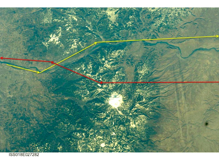
The image is from NASA’s Gateway to Astronaut Photography of the Earth:
The line in yellow shows the east-bound flight path used today, the red line shows the west-bound flight path. Today the prevailing wind is from the east, so flights departing PDX take-off to the west, heading directly to the Columbia River Gorge. Arriving flights loop around Vancouver, Washington and north Portland before landing to the east.
The Columbia River cuts a valley through the Cascade range between The Dalles, Oregon, and the Portland suburb of Troutdale, Oregon. The south side of the Gorge is known for its waterfalls, including Oregon’s second most visited tourist attraction, Multnomah Falls. On a clear day, passengers will see Mt St Helens, Mt Rainier, and Mt Adams on the north side of the plane. Mt Hood, Mt Jefferson, and the Three Sisters are often visible on the south side.
In the middle of Gorge lies Bonneville Dam, build on the toe of a very large landslide. Stevenson Washington and Cascade Locks, Oregon are located east of the dam.Hood River, Oregon is near the east end of the Gorge. The town is within a broad valley that runs from Mt Hood to Mt Adams.
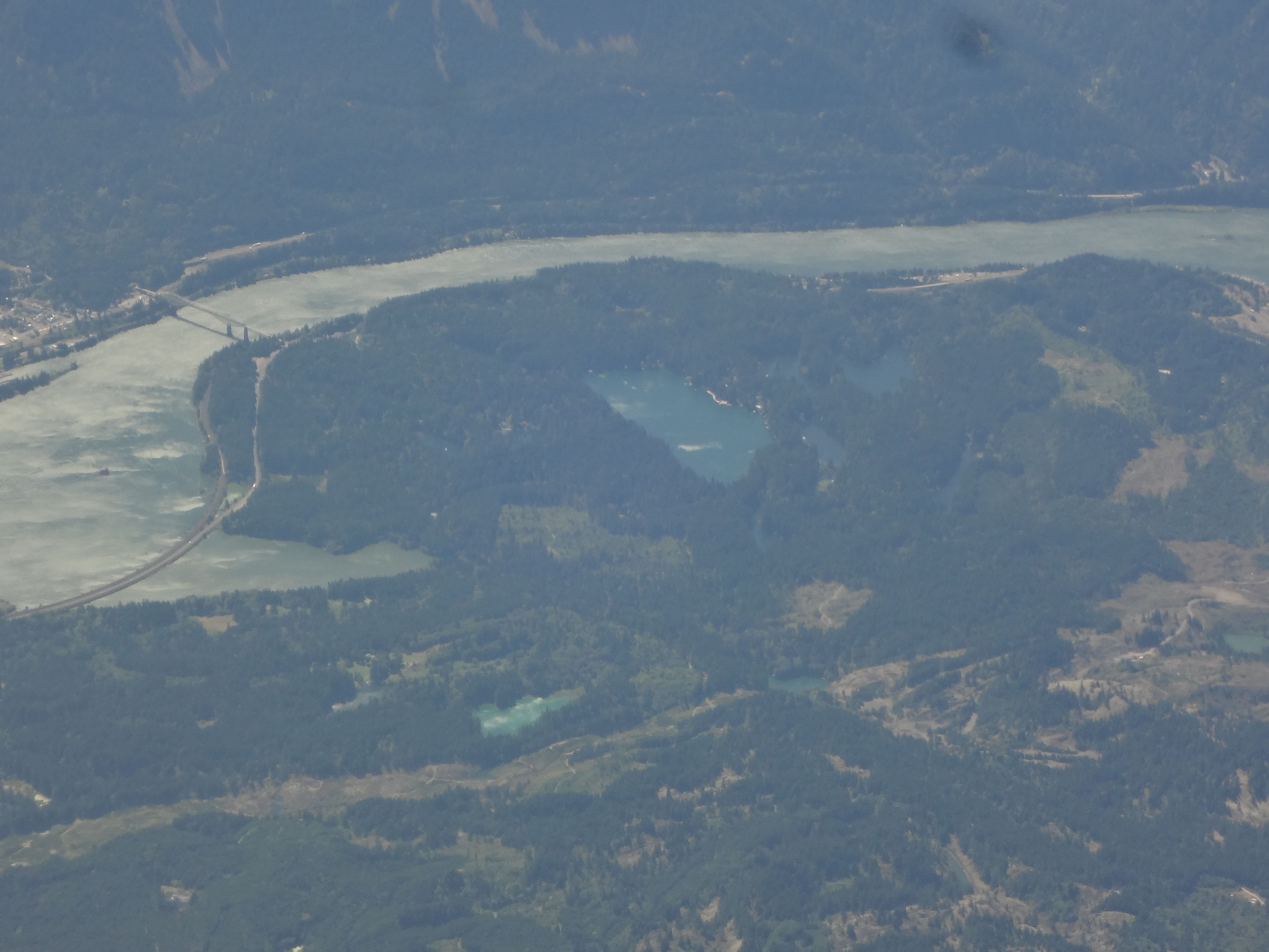
The Sandy River drains the west flank of Mt Hood and enters the Columbia River at the west end of the Gorge, just below Broughton Bluff.

The Sandy is a small river subject to large variations in stream flow. Somehow, it has deposited a large delta across the much larger Columbia River. When the Lewis and Clark expedition encountered the river on November 3, 1805, naming it the quick Sand River. Their journal notes the river divided in two branches six miles upstream from the Columbia, thus creating an island where the present delta lies. The Corps of Engineers modified the Sandy’s two outlets to improve the smelt run, thus creating the delta seen today.
One would expect the much larger Columbia to remove the delta created by the smaller Sandy River, and yet we see that delta displaces the Columbia to the north. How can this be? The Sandy River delta is underlain by mudflows that originated on Mt Hood in association with several volcanic eruptions. The mudflows carried a great volume of volcanic debris off the mountain, and then the Sandy moved the sediments 50 miles to the Columbia. Thus the Sandy River Delta is a distant deposit from several of Mt Hood’s eruptions. The most recent eruption occurred about ten years before the Lewis and Clark Expedition traversed the Gorge.
The Cascade Range is named for a major rapids seen by the Europeans in the center of the Gorge. These “Cascades” are now submerged beneath the lake behind Bonneville Dam. The town of Cascade Locks serviced the locks that enabled small ships to move past the cascade.

A large landslide crosses the Columbia at the cascades. Its headwall is on the Washington side of the river. The foot of slide includes several small lakes just north of the dam. The Bridge of Gods is upstream of the Bonneville Dam, at the west end of Cascade Locks.
The bridge takes its name from a native account of a catastrophic movement on the slides that blocked the river, creating a temporary dam.

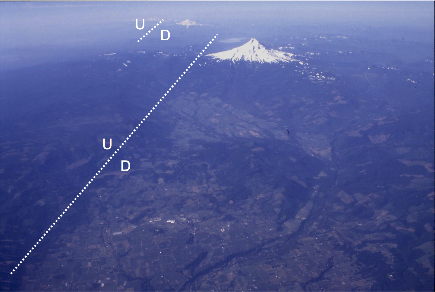
The small city of Hood River, Oregon is twenty-five miles east of Bonneville Dam. The Hood River Valley runs south from the city to Mt Hood. Fruit orchards are the main industry in the valley. The timber industry’s presence is revealed by the clear cuts in the nearby mountains. The east side of the valley is steeper than the west side. A fault runs along the east side of the valley, dropping the valley floor down several hundred feet. The fault is a major feature of the Oregon Cascades, and occurs south of Mt Hood to the east of Mt Jefferson.
Beyond Hood River, the Gorge merges with the Yakima Foldbelt and the Columbia Platean.